Circular Walk around Horning
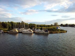
This is a walk that explores the lovely countryside around Horning but also visits the Parish Church and the main street in the Village with its quaint little shops and reputable pubs.

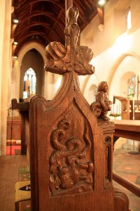
This is a walk that explores the lovely countryside around Horning but also visits the Parish Church and the main street in the Village with its quaint little shops and reputable pubs. It starts by heading off across open fields towards RAF Neatishead (now part of it is the Radar Museum and can be visited along the route if open). More fields are crossed and narrow lanes followed as you approach the 13th Century Parish Church of St Benedict which stands almost alone and a good half mile or so from the main village which has built up along the River Bure.
1) From the Swan Inn by the Staithe at Horning, keep the pay and display car park on your left and follow the road up to the main road junction by the village sign. Cross the road to join the country lane opposite leading you in the direction of Neatishead and the Radar Museum. After about 150m the road starts to bend round to the left and shortly after that there is a public footpath on the right taking you diagonally through the field and towards RAF Neatishead (the tall masts and radar buildings). Cross the field and continue to the road next to the RAF Base. Once on the road turn right and after about half a kilometre (0.3 miles) you will arrive at a road junction, continue along this same road (so ignore the one on the left) and just past the trees there is a public footpath on the right.

2) Turn right to follow the footpath through the open field to the South. Continue to the other side of the field where there is a tree line, the footpath turns 45 degrees to the left here and heads for the left side of the next field and joins a farmers track running south again. After another 200m or so the footpath heads across the open field to the left at a 45 degree angle. Cross the field to join the track way and then turn right which takes you south again and up to the main road.
3) Turn left and follow the road for just a short way and keep an eye out for the first road on the right which is opposite the first building you come to. Turn right down the narrow country lane and at the crossroads continue straight ahead. Continue to follow the road until you arrive at the parish church.

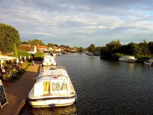
4) Once at the church follow the road round to the right and follow the lane up to the junction just next to the school. Turn left here and continue along the road which takes you back into Horning. You will pass a road leading down to the Ferry Inn and you will also pass several shops and also another pub called the New Inn before arriving back at the staithe by The Swan Inn.
Route and photographs supplied by Joe Jackson.