Circular Walk around Ludham Marshes
Ludham Marshes is a lovely area to walk around and designated a National Nature Reserve. The marshes are grazed by cattle during the summer months and a wide range of wildlife can be seen throughout the walk including Marsh Harriers soaring above.
The Broads National Park is a great place for anyone who enjoys walking, regardless of age or ability. There are miles of roads, country lanes and footpaths which connect the pretty Broadland villages with the surrounding countryside. Whether you are planning to rent a waterside cottage or hire a cruiser on the Broads walking is a great way to explore the National Park and discover the unique beauty of the Norfolk Broads.
Over the coming months we will be bringing you a selection of walks from around the Northern Broads that are ideal to incorporate in to your holiday. The walks will vary in lengths and difficulties and all of the walks will start close to moorings and a car park. The first of our walks is Ludham Marshes.
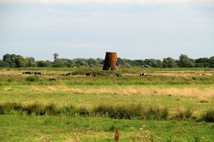
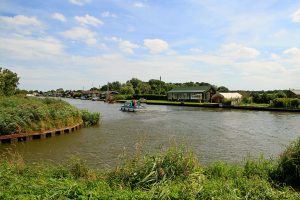
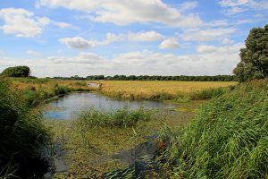
Ludham Marshes is a lovely area to walk around and designated a National Nature Reserve. The marshes are grazed by cattle during the summer months and a wide range of wildlife can be seen throughout the walk including Marsh Harriers soaring above. Womack Water Drainage Mill is seen for a long section of the walk which stands at 23ft high and now ruinous. In the summer months the air is buzzing with insects and butterflies and many varieties of birds are to be seen all year round. Deer can also sometimes be spotted in the nearby wood, while on the river you will see sailing craft and water birds. The undergrowth can get quite high along the riverbank in the summer, so leg covering is recommended. Short enough for a gentle afternoon stroll, this walk offers something for everyone.
1. From the staithe at Womack Water walk up to the road and turn right. This will take you to the south east along Horsefen Road, past the public toilets and after about 1/3 of a mile you will arrive at the end of the road next to Hunters Boat Yard.

2. Just to the left of Hunters Boat Yard is a public footpath (not to be confused with the track in front of the house to the left which is also a public footpath). You need to follow the footpath down the side of Hunters Yard and towards Womack Water. The path meanders its way down to the River Thurne where it turns round to the left and continues along the edge of the river for about ¾ of a mile up to a pumping station by a metal bridge.

3. Cross the bridge onto the long straight track. Follow it away from the river for about 1/3 of a mile where it swings to the right. Continue a few hundred yards where you arrive at the end of a road. Turn left and follow the road past Lower Farm and up to the next house where there is a public footpath slightly hidden on the left directly opposite the house.

4. Follow the fairly straight track towards High Mill Hill. About a third of this section is along the edge of a field and joins a track which takes you down to the road. Once at the road turn left and follow the little country lane on the left which is Horsefen Road. This will take you back to the car park and moorings.
Route and photographs supplied by Joe Jackson.